| N | ||
| W | + | E |
| S |
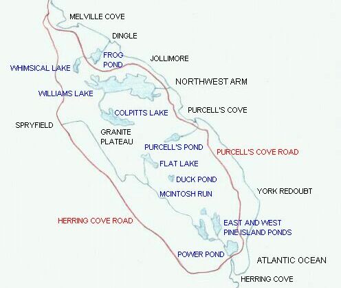
Map of the area in which the photographs were taken
On this map the two main roads in the area, the Herring Cove Road and the Purcell's Cove Road, are drawn in red. Blue is used to sketch lakes, streams, the McIntosh Run and the Atlantic coast (on the right-hand side of the map). The Northwest Arm is a narrow arm of the Atlantic Ocean which separates the area shown on the map from the Halifax peninsula. Click here to see a map of the larger area.